WHAT TO DO IN MONTESPERTOLI
A TERRITORY TO LIVE
AND DISCOVER AT A WALKING PACE
The Hill of Bottinaccio and Montecastello

The Itinerary
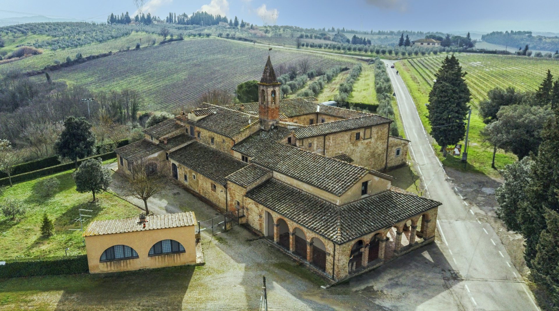
The route begins at the Sanctuary of Santa Maria della Pace in Bottinaccio, known as the Convento di Bottinaccio. There is the possibility (upon request) to visit the cloister and the church, which are open on holidays for the afternoon Mass. A visit is recommended as the place is a key location for the people of Bottinaccio. The convent even had a vivarium, or a fish farm, made possible by the abundant water on the hill where the sacred site is located, despite the typical aridity of the Tuscan hills. Water is a significant element for this community, which has benefited from this precious and essential resource since the Middle Ages, thanks to the soil’s ability to store and filter meteorological water through springs and outcrops on the hill’s slopes. It is no coincidence that the Frescobaldi family, a powerful Florentine dynasty believed to have originated here, built their castle on the hilltop in the 12th century, which was later transformed into a villa-farm during the Modern Age. Besides building their castle, the Frescobaldi left their mark on the area, gathering the population around the church of Sant’Andrea, which the wealthy family adorned with a true artistic gem: a small panel depicting the Madonna and Child by the famous Filippo Lippi. Water, thus, is a foundational element for this community, as reflected in the etymology of the name Bottinaccio.
Starting from the Convento, follow the wide white road lined with two rows of cypress trees leading towards the wooded hill from which emerges the medieval tower of the Frescobaldi castle, now incorporated into the 17th-century villa. While we know some details about the 13th-14th century castle from studies by Florentine medievalists, the history of the villa that replaced it when the military presence of these fortifications ended with the Middle Ages is still unwritten.
The route continues along the old communal road of Lastrino, which connected Montecastello to Santa Maria a Pulica, on the opposite side of the Turbone valley. The descent into the valley begins with expansive views towards the NE: the Turbone stream valley and Poggio Pancoli hill, with the bell tower of San Donato at Livizzano and the tuft of cypresses marking the beautiful Poggio Capponi farm to the left. Beyond the subsequent mountain ranges of Pratomagno, Monte Falterona, and the Apennines, the high hill crest of Chianti Fiorentino stretches SE. Along with the changing panorama, the soil also changes. Looking down, you can observe how the lithology changes: the whitish and rounded pebbles, covering the flat summit of Montecastello hill (which are related to the earlier discussion about water), give way to amber and bluish sands and clays. We are in Pozzaccia, depicted in a 1660 painting showing a hunting scene in these places; the painting shows a lime and brick kiln on the border between the Lastrino farm’s fields and the forest, demolished in the 1970s to make way for vineyards. The kiln was placed here because the plateau where the two farm buildings are located is the contact point between Conglomerate (the rounded pebbles) and clays and sands, the materials used in the kiln.
Proceeding past the Lastrino and Torricella farms of Montecastello, there is a beautiful view of the hill to our left, home to the rural village of Quarantola, which was already present in the 1427 Florentine cadastral survey. We reach the edge of the forest and, without delay, enter it, following a path that is the old 17th-18th century road connecting Montecastello to Pulica. A beautiful map in the Montespertoli historical archive provides undeniable evidence of its antiquity. The forest and the steep slope have preserved it from agricultural work that has transformed these hills since the 1970s, creating large vineyards that have trivialized and impoverished the classic Tuscan mezzadria landscape.
Descend almost to the Turbone stream plain to leave the old road and turn left into the forest, which wraps around the Bucignone stream’s bed, which we begin to ascend through thick vegetation. After several hundred meters of challenging terrain, we emerge from the narrow valley into the upper fields, reaching, at the top of the climb, the white road leading to Quarantola. Crossing it, we reach the ridge separating the Turbone valley from the Sammontana plain. On the ridge, we see the unattractive and anachronistic “Tuscan-style” settlement that replaced the ancient villa-farm owned by Senator Leonetti of Prato in the 19th century; to our left, the wooded valley of the Bucignone stream and the villa with its surrounding forest are visible. Passing by the ancient Marta nucleus with its imposing yet well-proportioned quadrangular farm building, we keep left at the junction to pass near the Amore farm and reach the asphalt road. We cross it and enter the forest via a wide, flat dirt road that first borders an open field. At the end of this field, we keep left through the maze of paths that thin out into the cypress grove. We pass the Bottinaccio cemetery (on our right) and, by following a country road parallel to the main road, reach the village of Bottinaccio, which we circumnavigate from the west, paying attention to the ancient water-related structures that, until the arrival of the aqueduct in the 1990s, were used by the small community.
Indeed, both the Rose Well, partially hidden by vegetation and integrated into the surviving wall, and the “Pillone del Palazzaccio,” consisting like the other Bottinaccio pillones of three interconnected water containers, served both the population and livestock and for irrigating gardens. As mentioned earlier, the entire historic village of Bottinaccio is situated on a small, crescent-shaped plateau, about one and a half hectares in size, with its edges marked by a clear elevation change of several meters.
The outcropping lithology is Conglomerate, but beneath it seems to be a clay lens that explains the spring water emerging at several points at the base of this small plateau. Historically, people highly valued this water source, even in minimal forms, explaining the presence not only in the etymology of the microtoponym Bottinaccio but also the presence of wells, pillones, washhouses, and storage tanks for this precious liquid around the historic village.
Passing through the houses, we first skirt the Palazzaccio (on our left), a historic Frescobaldi building with visible historical layers, and the church of Sant’Andrea (on the right). We continue to cross the asphalt road and use the fields above to head towards the Convento, but not before making the last stop at a 19th-century structure, still fundamental for local traffic. Beside the road, notice a low brick wall forming the head of a massive retaining wall allowing the road to cross a significant elevation change where the springs of the Tomba di Berto stream are located. We return to the tree-lined avenue we followed at the beginning to reach the Convento di Bottinaccio once more.
The Cipressa of Montecastello to Bottinaccio
“Hello! They call me ‘La Cipressa,’ and I am very old. No one can remember when I was planted. I am located at the center of a crossroads leading to Montecastello, once a farm of the Frescobaldi family, the former owners of this land.
In front of me is the view of the Convento di Santa Maria della Pace, which the Franciscan Friars built on the site of a chapel dedicated to the Madonna. I wasn’t here yet, but our ancestral trees passed down the memory of a shepherdess who, in 1580, heard the voice of the Madonna right here at a place then called Le Tre Vie. From this vantage point, I have witnessed many events. I remember another miraculous occurrence: Christ turning during the festival of the naked. Try asking around at the now historic Bar di Silvano Cianti to see if anyone still remembers!
And so many changes! When I was young, the countryside was inhabited, and the Convento had its religious community. Everything was connected, and the dirt road facilitated exchanges with the valley.
How many people have I seen pass by, arrive, and leave! How many wagon wheels have I seen bounce and roll away! And so many people on foot with loads on their shoulders! Many would rest under my branches to rest, talk, and even play. It was fun to hide behind my trunk, and how stimulating it was to imagine among my cypress brothers with their thousand faces!
Over time, everything has changed. Cars, always faster, pass by without stopping. Many of the residents have moved to the city. The Convento lights up only a few days a week.
But next to me, a large refreshment facility attracts people and keeps this place a point of gathering.
So stop for a moment, you who pass by here! Rest under my branches and with your imagination, you can picture my story.”
Gallery
Information
WHERE
Northern part of the municipality; Sanctuary of Santa Maria della Pace, Montecastello villa, and Bottinaccio village.
TIME REQUIRED
1h 40′
TIME REQUIRED WITH STOPS
2h 15′
LENGTH OF THE ROUTE
5.5 km
ELEVATION
↑ Ascent 210 m
↓ Descent 210 m
DIFFICULTY LEVEL
Medium
TYPE OF WALK
Landscape and historical-architectural; circular route
WATER SUPPLY ALONG THE ROUTE
Yes, at some of the houses you will encounter
PRACTICAL TIPS
During the summer season, it is advisable to avoid this route during the middle of the day, as it is largely exposed to the sun. In autumn, winter, and spring, any time of day is suitable.
Extra content (in Italian)
Cartography
Altimetry
GPS Track
Map
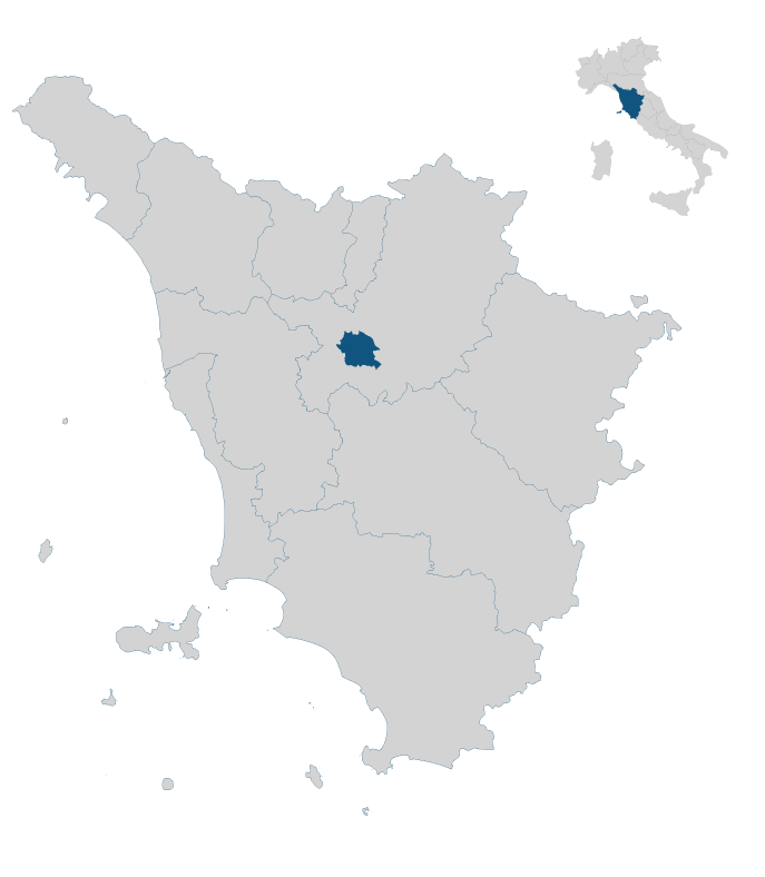
In the heart of Tuscany


