WHAT TO DO IN MONTESPERTOLI
A TERRITORY TO LIVE
AND DISCOVER AT A WALKING PACE
The Valley of the Chiocciolino River

The Itinerary
The itinerary starts at the small cemetery of Montalbino, a rural village that, during the late Middle Ages, had a history populated by prominent figures and artists in the Tuscan and broader context. Today, its peripheral location, the quiet countryside that surrounds it, and the secondary road network that serves it do not suggest the vibrant life of this village during the fifteenth century under Florentine rule. The local church of San Giusto, in fact, preserved until a few years ago a triptych (now displayed at the Museum of Sacred Art in Montespertoli) created by Cenni di Francesco di Ser Cenni in 1400 for the patron Bicci d’Andrea. Another notable figure was “ser Nuccio” di Mazza, a notary born and living in this corner of the Florentine countryside in 1348, in the midst of the Middle Ages.
From the small cemetery, the route brushes past the hill where the village of Montalbino is located, with its church of San Giusto, descending to the restaurant La Lombricaia. Here, you leave the road to cross in front of the restaurant and take the country road that leads into the nearby woods. Enter a small dry ditch and descend about fifty meters until you intersect a country path, which you follow to the right. A short climb leads into a grove of downy oaks and holm oaks. Pass under steep sandy and clayey walls to intersect the first sign of a hiking trail prepared by the nearby agriturismo “Montalbino,” with its attached restaurant “La Lombricaia.” After passing a small equipped area and continuing downhill, you enter the woods, fording the Rio Chiocciolino, which is a small stream here but has deeply carved its bed due to the presence of easily erodible sands and clays.
Shortly after, the path exits the woods, offering a view of the hill (up to the right) where the former church of San Giorgio a Montalbino is now located, now the agriturismo “Le Fonti a San Giorgio,” our next destination. Heading toward the opposite edge of the open field, you reach the Rio Chiocciolino again. Cross it to reach the right bank, where you follow the current on a flat stretch until you reach a small tributary blocking your way. Turn left into the vegetation hiding the small ditch and follow it to the confluence with the Rio Chiocciolino. Here, turn right and begin following the current. Continue for a while inside the riverbed, jumping from one bank to the other until you exit to the right, climbing another tributary ditch of the Chiocciolino. The area is regularly frequented by a wolf specimen (or perhaps a hybrid), which has been repeatedly captured by a camera trap present in the area.
You then begin to climb out of the valley floor, taking advantage of the inter-farm road that leads into the woods, leaving behind the cultivated valley floor. Pass alongside a vineyard and then an olive grove until you reach the dirt road leading to the agriturismo Fonti a San Giorgio. The agriturismo is partly housed in the building that for several centuries (from the 13th century to the 1960s) functioned as a church (San Giorgio a Montalbino), a dependency of the parish church of San Pietro in Mercato. Around this church, the scattered small population, made up of sharecropping families working the surrounding farms, would gather. The name “Fonti” (meaning “springs”) contrasts with the area’s marked aridity, due to the presence of lithology made almost exclusively of sands and clays, which has always strongly limited the emergence of spring waters.
Leave Fonti a San Giorgio, taking the dirt road that climbs to a plateau where the view opens up to the left, towards the northwest, on the Pistoian Apennines, the Abetone, the Apuan Alps, and in the foreground, the valley of the Pesciola di Aliano. Shortly after, the small bell tower of the nearby abandoned church of San Lorenzo a Montalbino comes into view, one of the three that dotted this part of the Montespertoli countryside since the Middle Ages. When you reach the entrance to a villa (on your left), climb the country path on the hillock in front, called “Il Paretaio.” From here, you have an excellent view of the Rio Chiocciolino valley just crossed. On the right, on the hill, you can see the small bell tower of the church of Tresanti, one of the 40 parishes that depended on the church of San Piero in Mercato in the Middle Ages. To the left, the colonial dwellings (now restored) all share the same location on the ridge separating the Rio Chiocciolino from the Rio Pesciolino. This is because the ridge, by its nature, indicates a lithology more resistant to erosion than the valley floor—a fact well understood by past inhabitants through selective experience. Behind, the ridge separating the Valdelsa from the Valdera stands out, a “submerged Apennine,” an emergent ridge at the time when the Apennine (the real one) was emerging, but which remained ‘halfway’ so that its maximum altitude today is just over 600 meters. To the left, the famous skyline of San Gimignano can be recognized, with the two highest peaks of the entire Metalliferous Hills behind it in the distance: Poggio di Montieri and the Cornate di Gerfalco. Further to the left, the ridge of the Montagnola Senese closes the excellent panorama.
Before returning to the dirt road, a small etymological note on the microtoponym Paretaio is in order. It refers to a place used in past centuries for bird hunting by means of wires stretched between trees, intended to break the wings of birds that landed there at night to rest.
Return to the dirt road, continuing in the direction you were heading, which leads, after about a kilometer, to a point where the view opens up to the west. Shortly after, at the intersection with the paved road, turn right and follow it, observing another suggestive view, this time of the nearby villa-farm of Aliano with the underlying rural nucleus of Manzano and the medieval church. Finally, return to the starting point, not before passing in front of the restored Mensoli chapel, of sixteenth-century origins, which has long since become a private residence.
Pine of Montalbino: “The Inverted Tree”
This large pine tree, which bifurcates almost from its base, has something special about it. It looks like a human being upside down, with its legs in the air! It evokes a symbolic image present in many cultures: the inverted tree.
“Man is like a tree in the field,”
says a verse from Deuteronomy. However, while a tree draws nourishment from below, man draws it from above.
“Man is a celestial plant,
he is like an inverted tree,
whose roots stretch towards the sky
and branches towards the earth.”
— Platone
“Man is like an upside-down tree,
what in this tree are the root, trunk, and foliage,
in man are the head and the rest of the body with arms and feet.”
— Andrea Alciati, 16th-century humanist
“He who knows in the right way the tree
with its roots above and branches below
will not believe at all that death can kill it.”
— Kāṭha Upaniṣad
The inverted tree represents the cosmic principle of which man sees only the manifest part, while the nourishing, essential part remains hidden and invisible. From the branches stretched downward descend the rays of the divine among men, the rays of knowledge.
Gallery
Information
ROUTE OVERVIEW
The route offers an exploration of the southern part of the Montespertoli area, which is characterized by a strikingly different morpho-lithological makeup compared to the central-northern part. In the central-northern area, compact and tough lithologies prevail, capable of withstanding steep slopes. In the southern area, however, clays and sands dominate, giving the landscape its rounded and sinuous shapes. While to the north of the town, rounded alberese pebbles are ubiquitous, in the south, Pliocene shells take center stage. The route begins in a natural environment shaped by human intervention, developing in the valley of a small watercourse (partially within its riverbed). This contrasts with the second section, which follows the long ridge dividing the Rio Chiocciolino from the Pesciola di Aliano, where humans have built churches, manor houses, and farmhouses since medieval times. These structures remain today, albeit with different uses.
LOCATION:
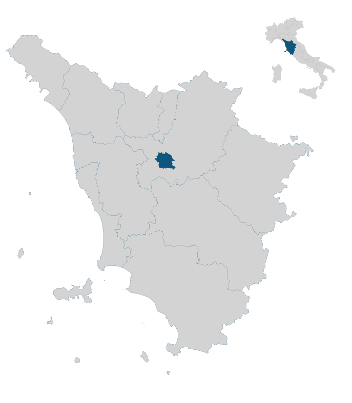
Southern part of the municipality, along the border with Certaldo, between the village of Montalbino and the former church of San Giorgio a Montalbino.
DURATION:
3 hours and 10 minutes
LENGTH:
7.1 km
ELEVATION GAIN/LOSS:
Ascent: 312 m
Descent: 312 m
DIFFICULTY:
Easy
WALK TYPE:
Scenic; circular route
WATER SUPPLY ALONG THE ROUTE:
Yes, available at some houses along the way
PRACTICAL ADVICE
The best time of year to take this route is in spring and autumn. If undertaken in summer, it’s recommended to start either early in the morning or late in the afternoon.
Extra content (in Italian)
Cartography
Altimetry
GPS Track
Map
In the heart of Tuscany


